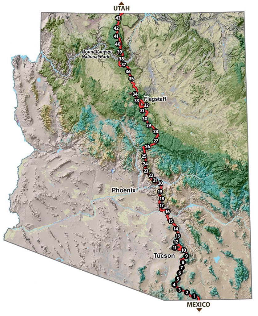
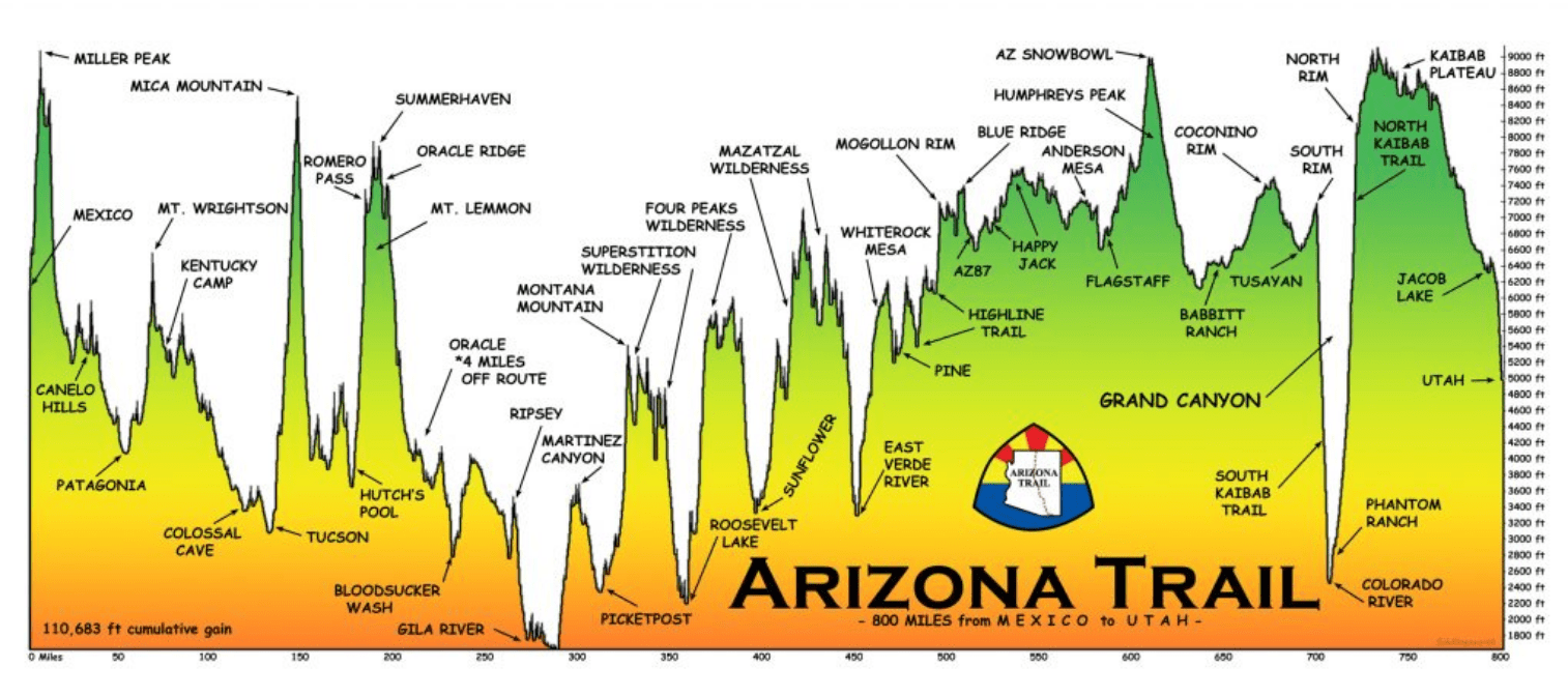
The Arizona Trail (AZT) begins at the US-Mexico border, traversing biomes ranging from desert to boreal forest. Continuing North across the Sonoran Desert, the route crosses Saguaro National Park & the Gila River, then winds through the Superstition Mountains and the Mazatzal Wilderness on its way to the Mogollon Rim and the San Francisco Peaks. The trail north takes hikers across the Grand Canyon, and topping out on the North Rim. On the Kaibab Plateau, the trail winds through conifer forests and red bluffs, and finishes at the Utah border on the edge of the Vermilion Cliffs National Monument.

Because I will be hiking the trail in autumn, I will travel in the reverse direction, going south from the Utah border. Hiking southbound means I’m running away from the approaching winter, and hopefully have warm (but not too warm!) weather most of the way. The northern half of the trail is more gentle, and will be a nice warmup. The southern half features more rugged terrain, particularly over the “sky islands”. Overall, there are 110,000ft (34,000m) of elevation gain over the trail’s distance.

I plan to start at the beginning of October, and finish about 5 weeks later.
Daily Blog Posts:
Day 6: Leaving Grand Canyon NP
Day 8: Total Eclipse of the Trail
Day 10: Aspens and Speedy Hikers
Day 12: Hiking out of Flagstaff
Day 13: Anderson Mesa and Roadwalks
Day 16: Leaving the Colorado Plateau
Day 18: Entering the Mazatzal Wilderness
Day 23: Superstition Wilderness
Day 27: Down to the Gila River
Day 29: Low Desert, Night Hiking