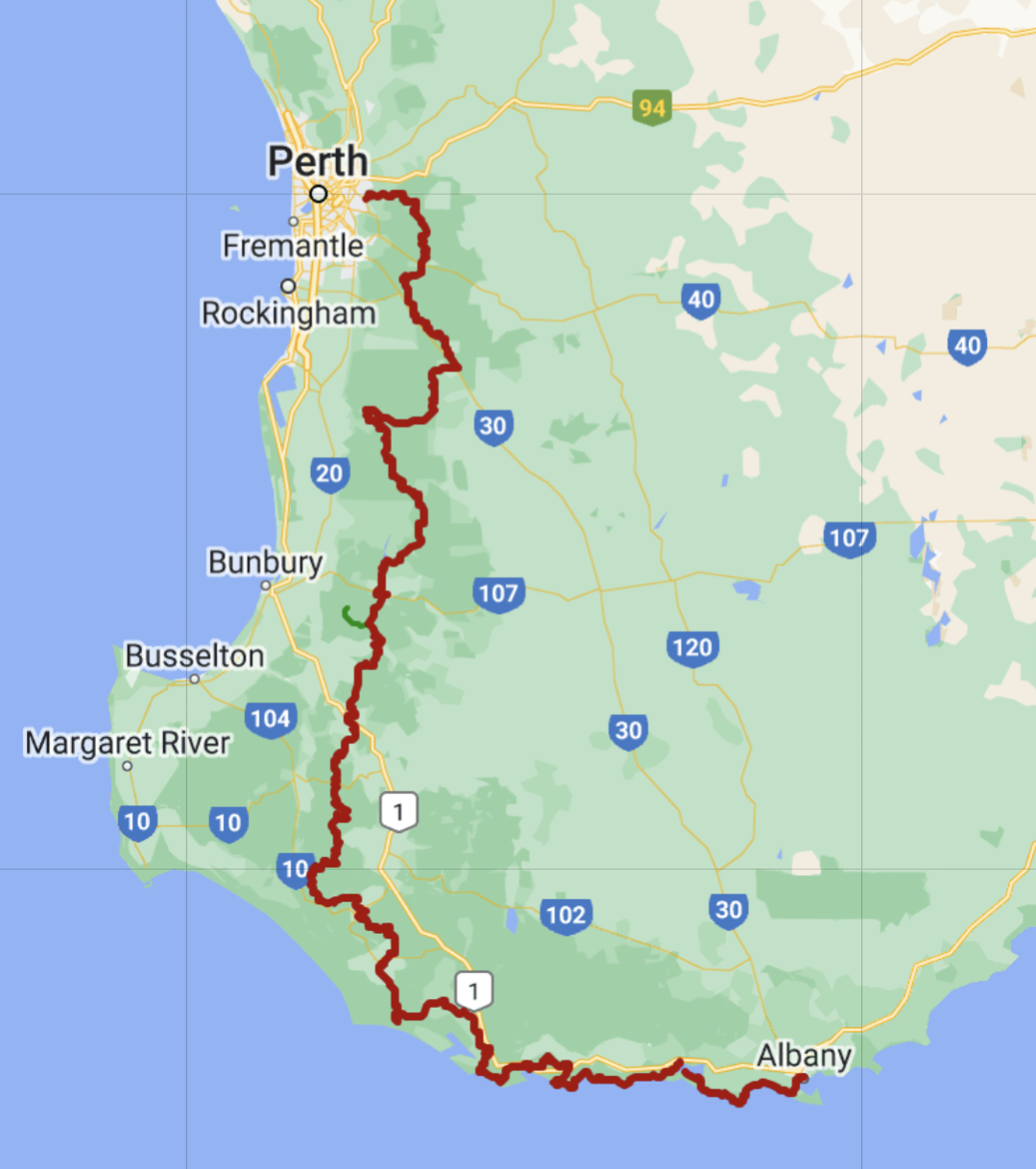
The Bibbulmun Track (BIB) is located in Western Australia, stretching 1000km (621mi) from Kalamunda (near Perth), to Albany on the south coast. It winds through the Darling mountain range, and the heart of the scenic Southwest of Australia.

The guidebooks and maps are written from a southbound perspective, which is the same direction that I’ll be hiking. I expect to finish in Albany after about 30 days of hiking, averaging about 34km/21mi per day. This might sound fast, but there is relatively little elevation gain/loss on this trail. Also, the trail goes thru 9 towns along the way, which means I never need to carry more than 5 days’ worth of food! I love having a light backpack.
I chose a southbound direction for a couple reasons, it’s logistically simpler since I’m flying into Perth already, and I will finish the hotter northern part before the summer bushfire season starts.
Much like the Larapinta Trail, established campsites are built every 10-15km or so, with 3-sided roofed structures, long-drop toilets, picnic tables, and water tanks. It’s basically Australia’s version of the AT…but with bushfires and tiger snakes.
Along with snakes, I expect to see kangaroos, emus, parrots, karri and tingle forests, mist-shrouded valleys, wildflowers, and marshy coastal wetlands. And a few thousand of these trail markers:

The marker depicts a Rainbow Serpent, or Wagyl, which is part of the Noongar (Southwest Australian Aboriginal tribe) mythology.
Daily Blog Posts:
Preparing for Western Australia
Day 2: Rolling thru the Forest
Day 4: Monadnocks National Park
Day 7: Short Day to Dwellingup
Day 8: Out of Town, Into a Crowd
Day 9: Hiking and Swimming the Murray River
Day 10: Full of Unexpected Things
Day 12: Into the Watery Region
Day 14: Long Day thru Balingup
Day 16: Crisscrossing the Donnelly River
Day 18: Foggy Morning into Pemberton
Day 20: Forests, Pastures, and Coastal Plains
Day 21: Snakes on a (coastal) Plain
Day 25: Tall Tingles and Low Tides
Day 26: Peaceful Bay, Canoeing, Roos