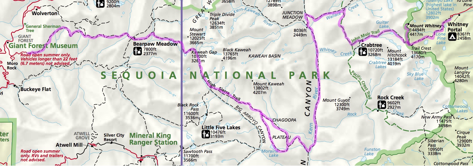
The High Sierra Trail (“HST”) is a 75-mile/120km hiking trail across the crest of the Sierra Nevada mountains in California. The trail is well marked along its route across Sequoia National Park, but I will still carry a Trails Illustrated topo map. The trail is usually hiked from West to East (Crescent Meadow to the John Muir Trail), but I will hike it the opposite direction, to get back to my car in Kings Canyon. The elevations generally aren’t that high, staying around 8000ft (2440m), except crossing the Kaweah Gap at 10,700ft. The SHR connects to the popular John Muir Trail, shown as the dashed green line on the map below. I will start from the town of Lone Pine, and get a ride up to Cottonwood Pass. From there, I will hike the Pacific Crest Trail northbound for a day, to meet the the HST’s eastern terminus at Wallace Creek. The entire route is on a well-established trail, so I expect to cruise my normal daily mileage (20-24mi). It will be exciting to explore the depths of Sequoia NP and the Kern Canyon!

The elevation profile has just two high points:

Daily Blog posts: