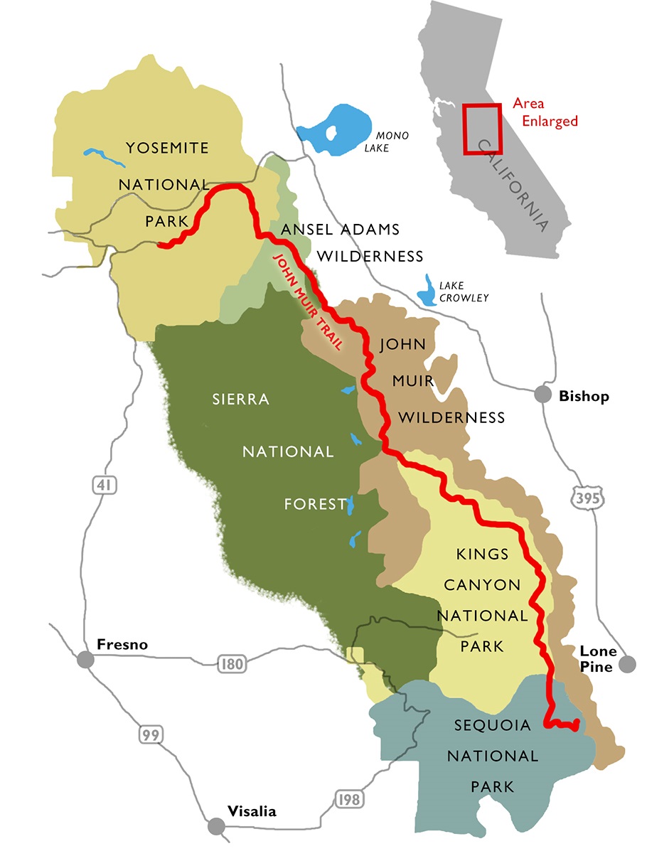
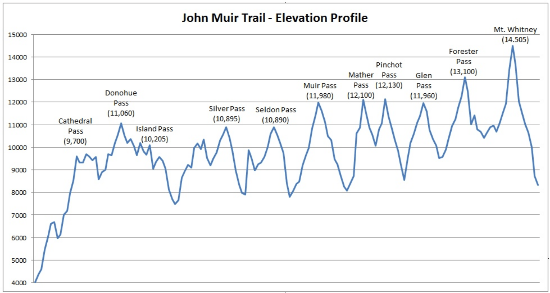
The John Muir Trail (“JMT”), is a 214-mile long-distance hiking trail in the Sierra Nevada mountains of California. It was named for the famous Scottish-American naturalist, and established as an official trail in 1915. Over its 344km/214mi length, it traverses the length of the Sierra Mountains from Yosemite Valley to the summit of Mt Whitney. A hiker will climb over 10 named passes, travel through 3 National Parks, both the Inyo and Sierra National forests, the John Muir and Ansel Adams wildernesses, and the Devils Postpile National Monument. The trail is very high in elevation, often traveling above treeline, and reaching a highpoint at its southern terminus on the summit of 14,505ft (4421m) Mt. Whitney. About 170 miles (80%) of the JMT are shared with the PCT.

A hiker traveling Southbound (the most predominant direction) will climb about 46,000ft (14,000m) over the course of the trail. Ouch!

Daily Blog Posts:
Day 2: JMT lakes and Red’s Meadow
Day 3: Back on Trail…and then Falling off
Day 4: Silver Pass, Yellow Leaves
Day 5: Selden Pass and a Spoon-ing
Day 8: Glen Pass & Forester Pass