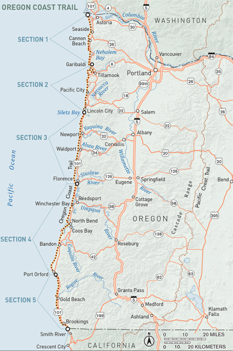
The Oregon Coast Trail is a 400mile / 644km route along the entire Oregon coast, from the Columbia River to the California border. The route is about half on the beach, and the rest is on trails over the headlands, and about 10% on roads. It starts at the Columbia River (Washington border), and most hikers will travel southbound, to keep the ever-present coastal wind at your back.
The main challenge of the route is camping; much of the coast is developed, so legal camping is at very specific locations, usually at state parks and private campgrounds. With a little planning ahead, it should be fine, and the more remote southern coast does have some legal “at large” beach camping. There are towns quite frequently, as shown on the map:

The hike should take me about 20 days, as I plan to average 20 miles per day on the flatter terrain. This hike was a last-minute suggestion of my Hayduke hiking partner Shadow, when I was asking about trail options to fill a 4-week time gap in my hiking schedule. (Thanks Shadow!)
Daily Blog Posts:
Day 1: Cars, Trains, Buses, Feet
Day 3: Tillamook Head and Cannon Beach
Day 4: Neahkahnie Mountain to Nehalem Boat Ferry
Day 5: Boats, Bays, Lighthouses
Day 6: Racing the Tide and the Rain
Day 8: Bushwhacking to the Beach
Day 9: Waves, Whales, and Lighthouses
Day 10 and 11: Double Zero on the Olympic Coast
Day 13: Seals, Statues, and Sandy Sauntering
Day 14: Heceta Lighthouse, Dark Tunnel
Day 15: Oregon Dunes National Rec Area
Day 16: Racing the Tide, Slogging thru Sand
Day 18: It’s Always Cold and Windy
Day 19: Swimming the Sixes and Cape Blanco