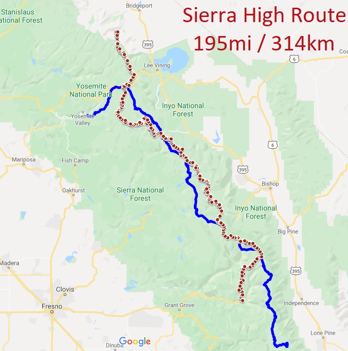
The Sierra High Route (“SHR”) is a 195-mile/314km cross-country hiking route along the crest of the Sierra Nevada mountains in California. I will navigate the mostly-trailless route using topo maps, and the descriptions in Steve Roper’s book Traversing Timberline. The route generally travels between elevations of 9,000ft and 12,000ft (2700m to 3600m), and crosses 33 high passes. The SHR parallels the popular John Muir Trail, shown as a blue line on the map below. I will start at the southern terminus, at Roads End in Kings Canyon NP, and hike northbound to Twin Lakes. Because most of the hiking is off-trail, I expect the daily mileage to be lower than usual, probably 12-14 miles per day. There are few food resupply options this deep in the Sierras, so my backpack will be quite heavy with 8+ days of food, stored in the required bear canister…Ugh. But it will be amazing having such a long uninterrupted stretch of wilderness!

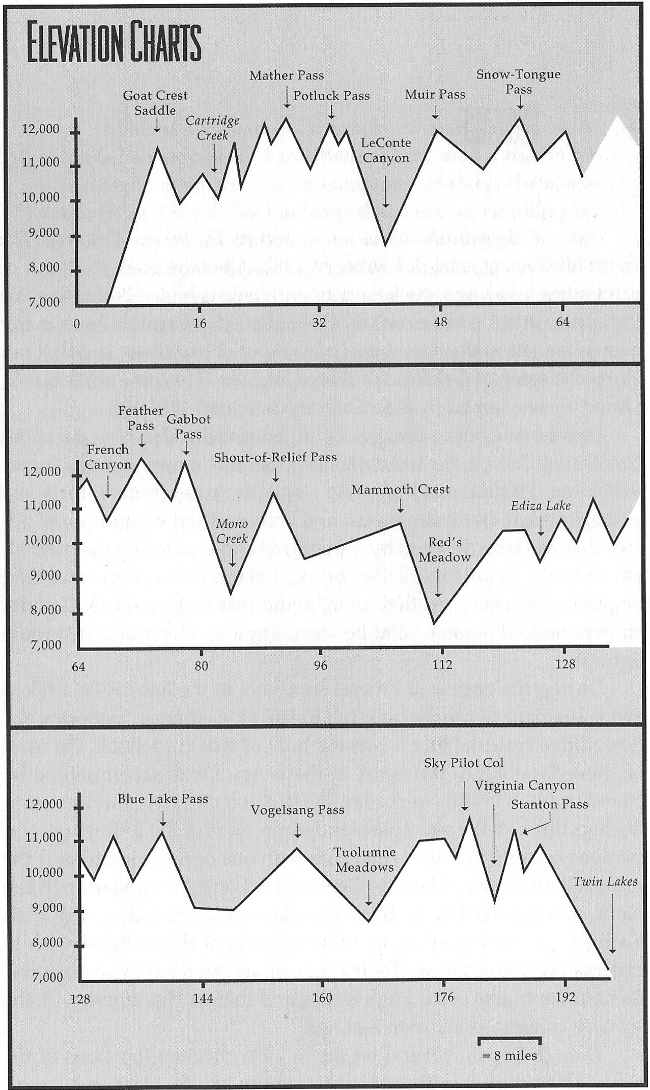
The elevation profile looks rather intimidating, too: (excerpted from Traversing Timberline)

Daily Blog posts:
Double Zero: Bigfoot Trail to Sierra High Route
Day 1: Into the Dark
Day 2: Higher to Alpine Lakes
Day 3: Passes of all Colors
Day 4: Puzzling Passes
Day 5: Muir Pass and People
Day 6: Snow Tongue Pass
Day 7: Bear Lakes Basin Birthday
Day 8: Shout-of-Relief Pass
Day 9: Mammoth Crest
Day 10: Zero-ish day in Mammoth
Day 11: Devils Postpile
Day 12: Pass, Lake, Repeat
Day 13: Routefinding is Slow
Day 14: Trails to Tuolumne
Day 15: Dome Roamin’ and Alpine Mines
Day 16: Triple Passes Day
Day 17: Down to Finish at Twin Lakes