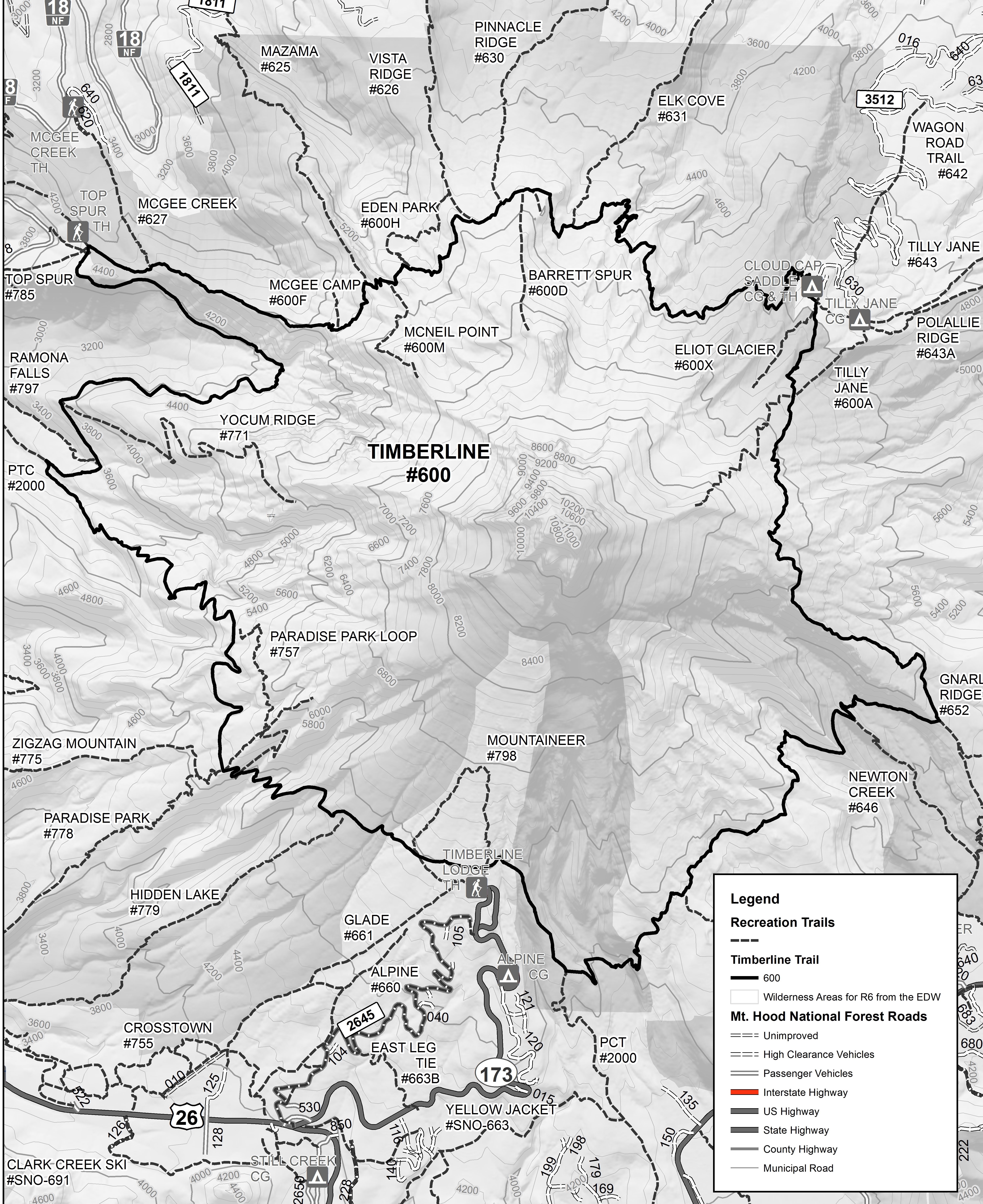
The Timberline Trail (“TLT”) is a 41.5-mile/66.8km National Historic Trail that circumnavigates Mt Hood in the Cascade Mountains of Oregon. The trail ranges in elevation from 7320 feet at a Saddle on Cooper Spur, to just 3400 feet at the Sandy River, and climbs 8,720ft/2963m over its length*. The TLT is almost completely within Mount Hood National Forest and the Mt Hood Wilderness, and requires free permits to camp during the peak season of May-September. Along the way, I passed alpine vistas, waterfalls, alpine meadows and dense fir forests. The trail was constructed primarily by Civilian Conservation Corps in the 1930’s and encircles Mount Hood at or near treeline (timberline), hence the name.

Despite the trail’s proximity to civilization (only 90 minutes from Portland OR), it feels like a remote backcountry adventure, since all of the stream crossings are unbridged. Hikers must ford the fast-moving glacial rivers, which are usually only knee-deep but challenging nonetheless. Some of the more difficult fords were crossing the Newton, Eliot, Coe, Muddy Fork, Sandy and White Rivers.
I started at Timberline Lodge and hiked clockwise, shown in the elevation profile here. Most hikers follow this same strategy, though there are also entry points at Cloud Cap Campground and Top Spur Trailhead.

*Due to the September 2020 windstorm, a section of the trail between Muddy Fork and Yocum Ridge is impassable due to widespread tree blowdown. I took a detour using the PCT, dropping down to 2800ft and crossing the Muddy Fork River. I re-joined the TLT at the Top Spur Trailhead, which shortened the hike by a mile but added 1000ft of elevation gain (40.4mi long, 9720ft gain).
Daily Blog posts: