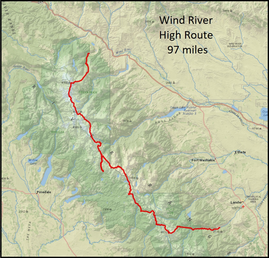
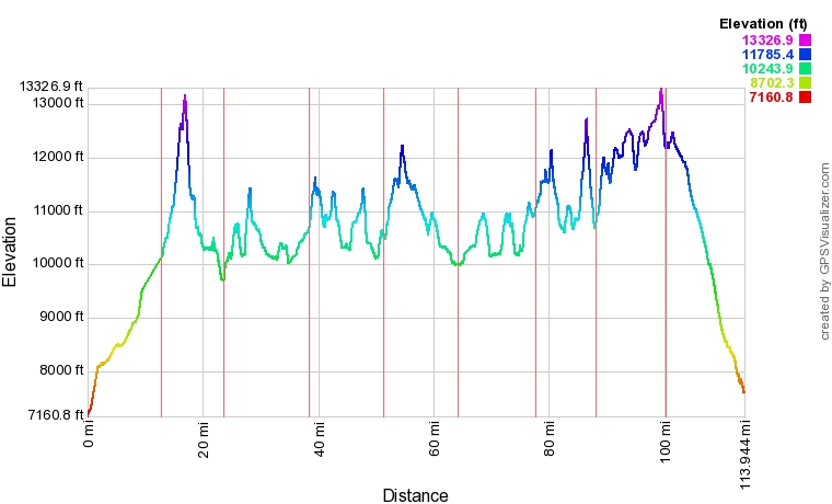
The Wind River High Route (“WRHR”) is a 97-mile/156km alpine hiking route that travels generally south-north along the crest of the Wind River Range in western Wyoming. It is a route that I’ve been itching to do ever since I hiked through here on the CDT in 2016. The WRHR shares about 10 miles of trail with the CDT in the Cirque of the Towers area, since we followed Andrew Skurka’s version of the route (there is another popular version of the route).
As a high route, it generally stays between 10-12,000ft in elevation, with a couple of climbs above 13,000ft/4000m on Wind River Peak and Downs Mountain. The hike is best described as a route, as 65 miles of it are off-trail, with only 32 miles on maintained trails. It climbs over nine high passes and three summits, drops into steep glacially carved valleys and alpine meadows, passes by hundreds of lakes and tarns, and even traverses several glaciers. The miles are hard earned (30,000ft of elevation gain), but so worth it! I was grateful to be hiking with Quickham, one of my CDT trail family, who has endless energy and is always great company.


Daily Blog posts:
Day 2: Wind River Peak and a Close Call
Day 4: Bagels, Bergschrunds, Llamas, and Lakes
Day 5: Europe Peak and Hay Pass
Day 6: Bonus Miles and Detours
Day 7: Four Hikertrash, Two Passes
Day 8: Glaciers and Downs Mountain